SIRIUS BASIC/PRO
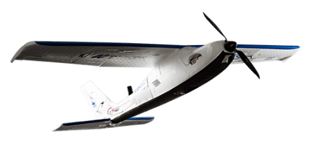
Instead of Ground Control Points, Sirius Pro uses GNSS RTK in combination with precision timing technology to determine the exact location for each of the positions at which a photo is taken. This precise positioning technology allows the image locations to be used as the equivalent of GCPs. As a result, project times can be decreased significantly and high accuracy mapping can now be done in areas without ground access.
The Sirius Basic brings all advantages of the Sirius Pro, except for GNSS-RTK.
Connectez-vous ou inscrivez-vous à myTopcon pour consulter cette page :
PRODUITS LIÉS
VIDéOS DE FORMATION
GUIDES RAPIDES
Sirius Pro: Before You Begin (Part 1 of 3)
Sirius Pro: Before You Begin (Part 1 of 3)
En savoir plus
Sirius Pro: Before You Begin (Part 2 of 3)
Sirius Pro: Before You Begin (Part 2 of 3)
En savoir plus