Topcon Context Capture - Importing a Localization
-
To import a local coordinate system into Topcon Context Capture, please perform the following steps:
- For a new Reconstruction, select the Spatial Framework tab.
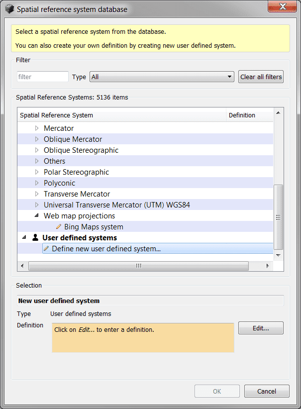
- Under the Spatial Reference system section, select Spatial Reference system database.
- Please note that the Spatial Reference system database can also be accessed when generating productions such as the 3D Mesh, 3D Point Cloud, Orthophoto/DSM.
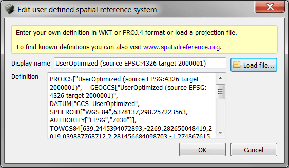
- Scroll down to the bottom of the coordinate system list and select Define new user defined system, then select Edit.
- Select Load File.
- Navigate to the directory on the PC where the *.wkt or *.prj file for the local coordinate system is located and select Open.
- Once Imported, select Ok.
- The local coordinate system can now be selected from the Spatial Reference system pull down menu.