Import Run
- Open Mobile Master Office
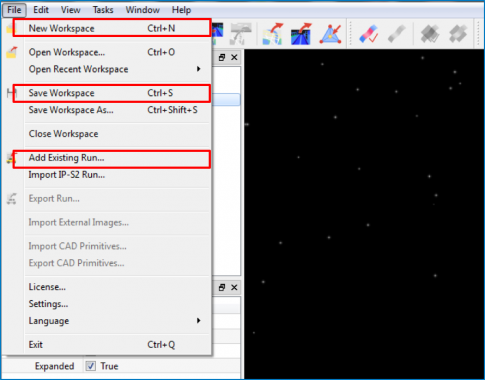
- Select File menu
- Select New Workspace
- Reopen File menu
- Select Add Existing Run…
- Navigate to the folder containing raw_rdmx.rdmx
- Select Open button
- Reopen File menu
- Select Save Workspace
- Name and save the workspace
Process Run
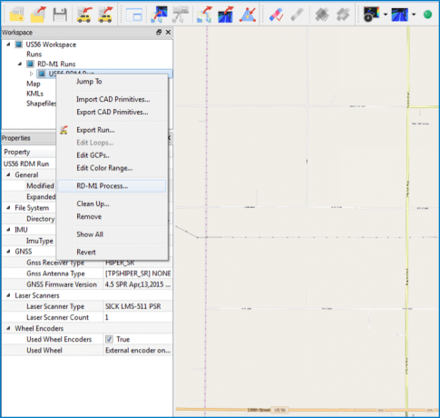
- Expand folders in workspace window
- Right-click on imported run
- Select RD-M1 Process…
Estimate Trajectory
-
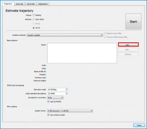
Leave at defaults
- Method – IP-S3
- Combine Method – Loosely coupled
- Elevation Mask – 10 deg
- Code Standard Deviation – 7m
- Ionospheric Correction – Auto
- Use GLONASS – Checked
- Quality Factor – 3
- Use Wheel Encoder – Checked
- Select Add… button
Estimate Trajectory – Add Base Station
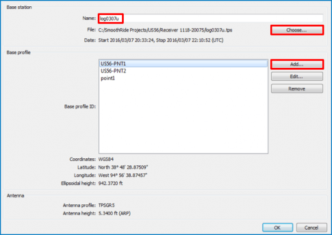
- Select Choose…
- Navigate to the static base log.tps file
- Select Open
- Enter a name for the base
- Select Add… button
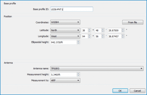
Estimate Trajectory – Add Base Profile
- Enter Base profile ID
- Enter adjusted position data (coordinates) from MAGNET Office Tools
- Select Antenna name
- Enter Measurement height
- Select ARP from the Measurement to: dropdown
- Select OK twice to return to the trajectory tab
- Repeat Add… for multiple bases
- Select Start to process the trajectory
Pose Scan – Calculate Max Scan Range
-
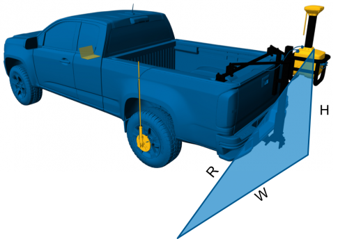
Note the height on the RD-M1 during the scan as H (in meters)
- 1.000 m = 3.28083333ft
- Note half the desired scan width per pass as W (also meters)
-
Calculate max scan range (R) as follows:
- R = √(H² + W²)
- Recommend a scan range of less than 5 meters
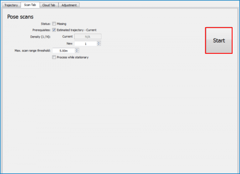
Pose Scan
- Set new Density value to 1
- Enter Max. scan range threshold (R) previously calculated
- Select Start
Create and Filter Point Cloud
Elevation by Position
Weighted by Proximity
Sigma = Radius (m)
Relates to Control
Foot Print 10cm – 15cm
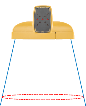
Set new point Density at 0.001
Enter Sigma of 0.100
Select Start
