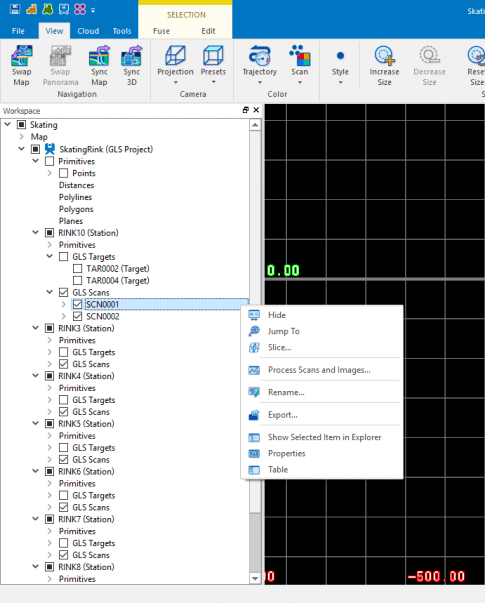
Right Click Option for Scanning
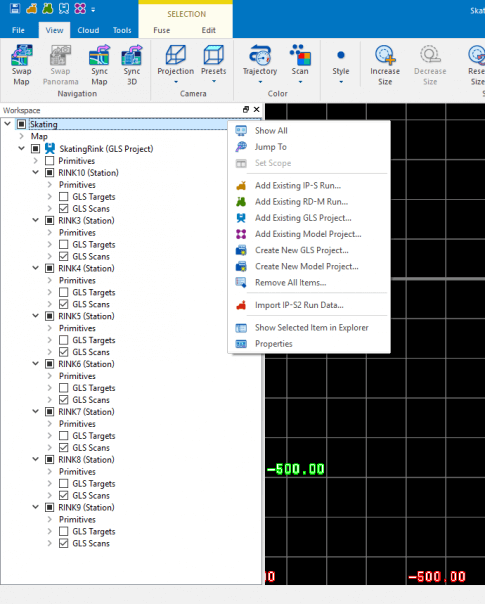
Model Level
- Show All
- Jump To
-
Add Existing
- IP-S Project
- RD-M1 Project
- GLS Project
-
Create
- New GLS Project
- New Model Project
- Remove All Items
- Show Selected in Explorer
- Properties
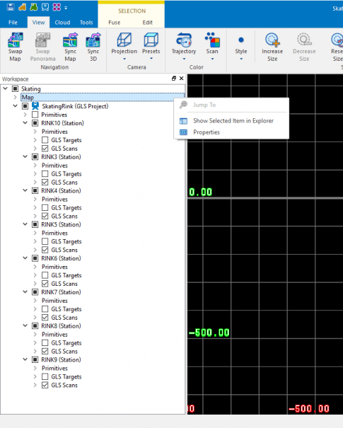
Map Level
- Show Selected Items in Explorer
- Properties
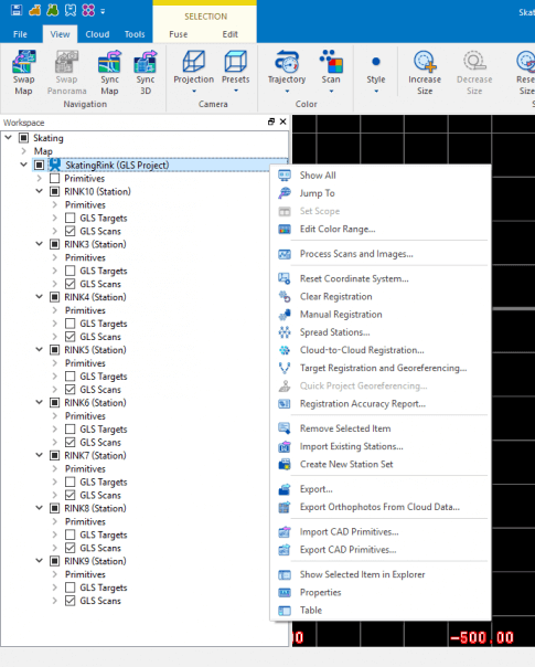
Project Level
-
Show All
-
Jump To
-
Edit Color Range
-
Process Scans and Images…
-
Reset Coordinate System…
-
Clear Registration
-
Manual Registration
-
Spread Stations
-
Cloud-to-Cloud Registration…
-
Target Registration and Georeferencing…
-
Registration Accuracy Report…
-
Remove Selected Item
-
Import Existing Stations…
-
Create New Station Set
-
Export…
-
Export Orthophotos From Cloud Data
-
Import CAD Primitives…
-
Export CAD Primitives…
-
Shows Selected Item in Explorer
-
Properties
-
Table
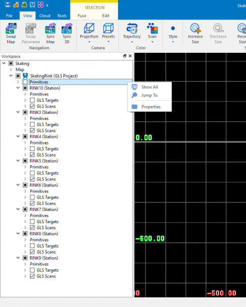
Primitives Level
- Show All
- Jump To
- Properties
Each Primitive has right-click options
-
Points
- Show All
- Jump To
- Delete All Items…
-
Distances
- Measure Distance
-
Polylines
- Draw Polyline
-
Polygons
- Draw Polygon
-
Plans
- Fit Plane
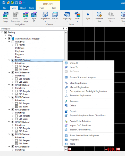
Station Level
- Show all
- Jump To
- Process Scans and Images…
- Clear Registration
- Manual Registration
- Occupation and Backsight Registration…
- Resection Registration…
- Rename
- Delete
- Export
- Export Orthophotos From Cloud Data…
- Create Point Primitive
- Import CAD Primitives…
- Export CAD Primitives…
- Show Selected Item in Explorer
- Properties
- Table
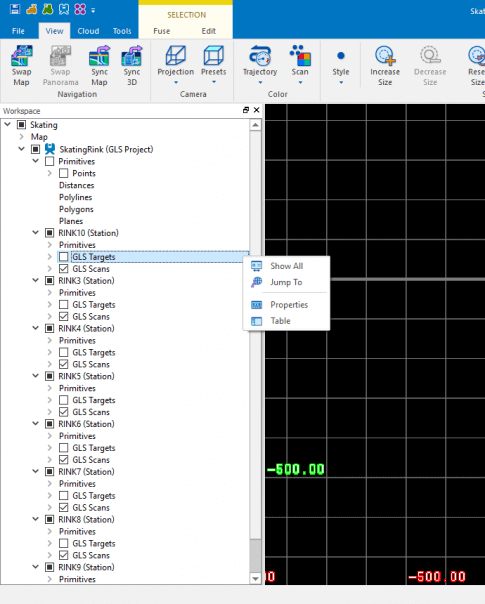
Target Level (Group)
- Show All
- Jump To
- Properties
- Table
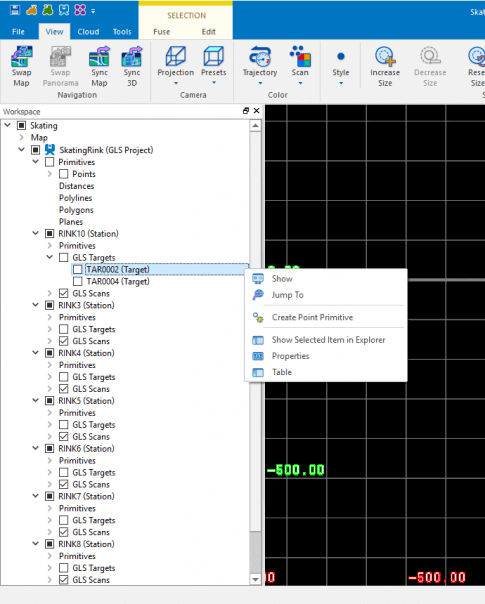
Target Level (Individual)
- Show All
- Jump To
- Properties
- Table
- Show
- Jump To
- Create Point Primitive
- Show Selected Item in Explorer
- Properties
- Table
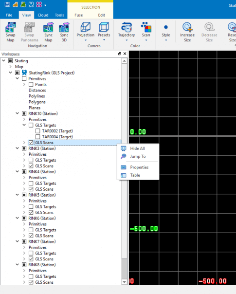
Scan Level (Group)
- Show All
- Jump To
- Properties
- Table
Scan Level (Individual)
- Show All
- Jump To
- Properties
- Table
- Hide
- Jump To
- Slice…
- Process Scans and Images…
- Rename
- Export…
- Show Selected Item in Explorer
- Properties
- Table
