Concrete Paving
Precision Paving, Delivered Automatically
Achieve greater production speeds,
even as accuracy rises.
Achieve greater production speeds, even as accuracy rises.
THE WORLD'S ONLY GNSS-GUIDED CONCRETE SOLUTIONS
Get the simplified workflow and greater flexibility that GNSS provides, and deliver superior results. Win the next bid.
Topcon and Ligchine combine for easy, cost-effective paving
Tackle concrete paving on any parking lot, approach, or ramp that has multiple elevation and grade changes. Using the versatile combination of our mmGPS system with the Ligchine extendable boom screed machine expands your paving capabilities. The Ligchine all-terrain track machine goes just about anywhere with minimal disturbance on multiple surfaces.
Prepare initial designs for your concrete paving job sites the right way. Our MAGNET Office software creates and exports the design details resulting in an intuitive machine control file for automated paving. The Ligchine screed automatically adjusts elevation and slope to millimeter precision with our proven N beam laser transmitter and receiver with embedded GNSS antenna.
Don’t lose time while paving. With our real-time position information constantly updating as well as Ligchine's wireless control of the machine, you efficiently manage material as it’s placed — delivering the highest quality in a fraction of the time.
Get more mileage out of your 3D system
The creative design of our 3D mmGPS system allows you to easily swap your components from one machine to another. For the days you’re not using your Ligchine machine, quickly transfer your system to a miller, asphalt paver, motor grader, or dozer for complete 3D control on all your projects.
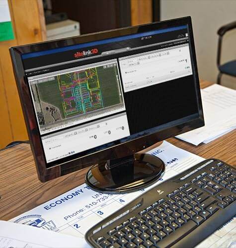
Project data from all machines is managed through a secure remote service Sitelink3D site management system and can be accessed from any browser or mobile device for minute-by-minute progress.
AN INTEGRATED CONCRETE PAVING SYSTEM
The 3D concrete paving solution from Topcon uses the same site plan and primary system components to automatically steer and control the screed on both curb & gutter and wide-form concrete pavers. A pole-mounted grade management system works in tandem with the machine-mounted system to assure grade and collect as-built points. Both receive vertical accuracy signals from the same N-Beam laser transmitter that, when combined with GNSS, provides millimeter-level accuracy. With Sitelink3D Enterprise connectivity, these systems join the site-wide management of job data, communication and support.
CHANGE THE WAY YOUR CUSTOMERS THINK ABOUT CONCRETE
Stringlines take time, offer little flexibility and require constant attention. The Topcon 3D Paving Solution starts fast, runs fast and gives you the flexibility to tackle different areas on short notice by eliminating all of the time and effort required to set up and maintain stringlines. Get out in front of the competition, and bring proven GNSS-based concrete control to your local market. The savings -- and the competitive edge -- are waiting for you.
GRADE CONTROL, FROM START TO FINISH
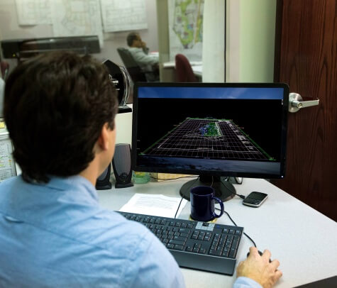
Topcon construction systems have developed over many years, and reflect the depth and breadth of our customers' experience using them to accomplish their work. Our concrete paving solution reflects and extends this heritage. Integrated with our site management tool SiteLink3D, and fully compatible with our other construction solutions, you now have an end-to-end site work solution, from initial topo to final as-built, with every step in between.
ROADING DESIGN MADE EASY
MAGNET Office Site's roading module has a suite of tools designed specifically for creating accurate, workable models to export for milling and paving control. Use centerline + cross-slope, TIN and other design methods. Employ the load-balancing tool to design paving based on available material. And set milling sub-grade, including super-elevated curves, to simplify paving and reduce time and material costs.
AUTOMATIC, MILLIMETER-ACCURATE GNSS
Streamline your workflow and enjoy far greater efficiency with our millimeter-accurate GNSS milling solution with automatic steering. Now you can use the same site plan as every other crew on the job while accessing the same GNSS controls. And you can mill to an offset from final paved surface, thus allowing for even-weighted lifts for material savings and improved performance. Work within the SiteLink3D site management system for improved data flow, including as-built data.
AN END TO STRINGLINES

Most milling and paving operations use stringlines as surveyed references. With this solution, you’ll no longer need them, thanks to GNSS with N-Beam augmentation. This millimeter-accurate technology gives you the flexibility of GNSS with the accuracy of a laser or total station. Suddenly, all you need on the job are survey hubs, and your planning becomes more flexible. You're collaborating with the dirt guys and integrating the overall workflow, finding efficiencies and speeding up the schedule. It’s one surefire path to a happy client.
ROADING DESIGN MADE EASY

MAGNET Office Site's roading module has a suite of tools designed specifically for creating accurate, workable models to export for milling and paving control. Use centerline + cross-slope, TIN and other design methods. Employ the load-balancing tool to design paving based on available material. And set milling sub-grade, including super-elevated curves, to simplify paving and reduce time and material costs.
Truly revolutionary products
No other manufacturer brings GNSS flexibility to paving,
with all the benefits, along with laser accuracy and ease or use.
For geopositioning, construction and mapping professionals the MAGNET suite links field to office in a secure online environment, improving management for entire teams.
Topcon has pioneered many of our greatest innovations specifically for our grading systems.
Unmatched grading speed, flexibility and accuracy using inertial sensing and superior
vertical accuracies using patented zone lasers for critical applications.
A long-time leader in paving, Topcon systems supply reliably excellent results with robust components
designed for the toughest paving conditions. Only Topcon has a 3D paving system with the flexibility of GNSS.
Our software is designed for the way you work, with both specialized and modular solutions that integrate with Topcon hardware, and cloud connectivity to bring it all together.
Topcon Enterprise Solutions are revolutionary anytime/anywhere connectivity and remote
management solutions that will make every geospatial and construction firm more productive.
Insights & testimonials
We've got you covered
Need more info?
We can email you additional product information. Your contact information will never be shared.
Reach out
Reach out to one of our partners for more information or a price quote. Use the link below to find an expert in your area ready to help your business software needs.
