Milling
Clearing The Path For Your Success
Getting the depth right the first time saves you time and costly rework. Our milling solutions give you the confidence to approach any job and deliver a quality cut - the first time
Getting the depth right the first time saves you time and costly rework. Our milling solutions give you the confidence to approach any job and deliver a quality cut - the first time
Set your job on the winning track from the get go
Our solutions start you with a detailed depiction of the surface before you begin. By taking out the guesswork, your road to success becomes a whole lot smoother.
AUTOMATIC, MILLIMETER-ACCURATE GNSS
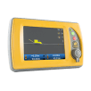
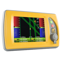
Streamline your workflow and enjoy far greater efficiency with our millimeter-accurate GNSS milling solution with automatic steering. Now you can use the same site plan as every other crew on the job while accessing the same GNSS controls. And you can mill to an offset from final paved surface, thus allowing for even-weighted lifts for material savings and improved performance. Work within the SiteLink3D site management system for improved data flow, including as-built data.
AN END TO STRINGLINES

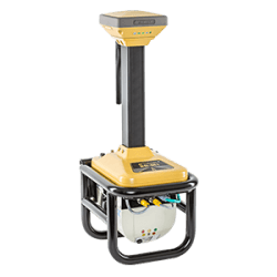
Most milling and paving operations use stringlines as surveyed references. With this solution, you’ll no longer need them, thanks to GNSS with N-Beam augmentation. This millimeter-accurate technology gives you the flexibility of GNSS with the accuracy of a laser or total station. Suddenly, all you need on the job are survey hubs, and your planning becomes more flexible. You're collaborating with the dirt guys and integrating the overall workflow, finding efficiencies and speeding up the schedule. It’s one surefire path to a happy client.
ROADING DESIGN MADE EASY

MAGNET Office Site's roading module has a suite of tools designed specifically for creating accurate, workable models to export for milling and paving control. Use centerline + cross-slope, TIN and other design methods. Employ the load-balancing tool to design paving based on available material. And set milling sub-grade, including super-elevated curves, to simplify paving and reduce time and material costs.
For geopositioning, construction and mapping professionals the MAGNET suite links field to office in a secure online environment, improving management for entire teams.
Topcon has pioneered many of our greatest innovations specifically for our grading systems.
Unmatched grading speed, flexibility and accuracy using inertial sensing and superior
vertical accuracies using patented zone lasers for critical applications.
A long-time leader in paving, Topcon systems supply reliably excellent results with robust components designed
for the toughest paving conditions. Only Topcon has a 3D paving system with the flexibility of GNSS.
Employing deep integration with Topcon hardware, cloud connectivity and both specialized
and modular solutions, Topcon software packages are designed for the way you work.
Topcon Enterprise Solutions are revolutionary anytime/anywhere connectivity and remote
management solutions that will make every geospatial and construction firm more productive.
Insights & testimonials
We've got you covered
Need more info?
We can email you additional product information. Your contact information will never be shared.
See it in action
Your local dealer can't wait to show you what we can do for your business.
