Civil Engineering & Design
Build the Design
Our partnership with Autodesk allows design files to move quickly from engineers to field survey teams, improving information management throughout the design and build process.
Our partnership with Autodesk allows design files to move quickly from engineers to field survey teams, improving information management throughout the design and build process.
IMPLEMENT DESIGN INTENTIONS IN THE REAL WORLD
Controlling data flow, protecting its integrity, and improving communication between field and office are key elements as design concepts come to life, and stakeout transforms models into reality.
ALL ROADS LEAD HERE
The coordination, execution, and management of simple to complex road projects has been put in the fast lane. Leveraging the entire MAGNET system, each player gains the ability to perform their part of the larger project at ease.
While on the go, managers have instant access to their own secure environment using the no-cost MAGNET Enterprise Mobile app specific for Apple iPad devices. Whether standing directly at a potential project site or an existing active site, all of your project related data and team members are a screen tap and swipe away.
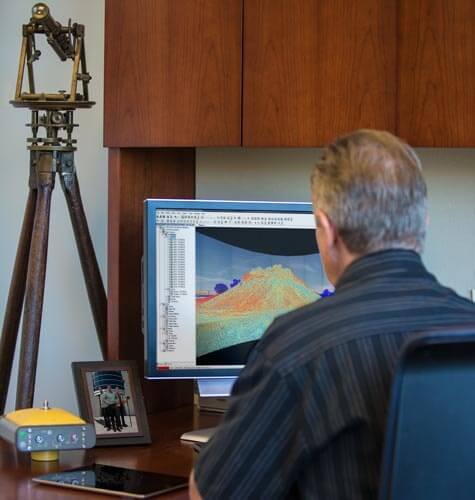
Office staff with MAGNET Office software enjoy the large library of industry file formats, intuitive options to further design, and vivid ability to see proposed work within a 3D fly through - to see challenges, before they become a problem.
Mobile field crews stay connected in their own comfort zone of MAGNET Field data collection software. The sky is the limit with customization. Each stakeout and field measurement is prompted and displayed just as each team member prefers it. Send up what was done, and download what needs to be tackled next, the MAGNET system brings teams together like never before.
IMPROVED FIELD AND OFFICE EFFICIENCY
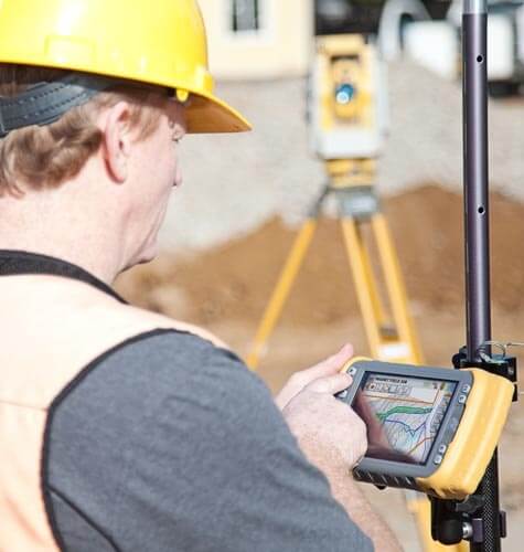
The connectivity is expected. Beyond that, getting the job done correctly and on time is clearly the goal for all players. MAGNET Field data collection software as well as MAGNET Office design suite each offer flexible customization options that streamline daily tasks.
Move anywhere along the defined centerline with confidence knowing that your accurate location is ready at anytime to represent design data onsite. Options for multiple stake references, offsets, and notice for any work that is out of tolerance is now common place.
Office staff rely on the fluid ability to import and work within existing design data, further that design with intuitive tools, and ultimately see what was done to gain confidence before moving on. MAGNET Office software offers easy ability to import, improve, isolate, to then see and share.
Dimensional Structure Location
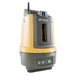
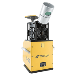
Each and every jobsite presents its own set of unique challenges. 3D laser scanners deployed under such circumstances need to be versatile enough to meet the varied demands of the job. Topcon’s GLS-2000 series offer three different models to choose from based on the range requirements of the target application.
Moreover, offering multiple measurement modes that enable switching between laser classes (3R/ 1M) on a scan-by-scan basis, the GLS-2000 scanners series deliver the perfect mix of industry leading technology and user-friendly operations.
AS-BUILT SESSIONS AT THE SPEED OF LIGHT
Combined with MAGNET Collage software, the GLS-2000 series provide users with a single solution to capture, visualize, and extract features from complex environments with an unmatched combination of speed, accuracy, and detail.
ARRIVE. SCAN. PERFORM.
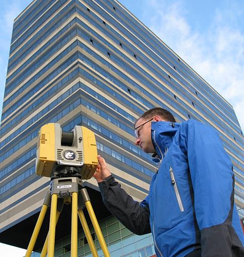
The three different GLS-2000 series model selection empower you to select the range requirements that best suit your needs. Selectable measurement modes, empowers you to choose the optimal scanning speed / range based on site conditions on a scan-by-scan basis. Each measurement mode setting allows you to achieve specified accuracies on just a single pass, reducing overall time per station setup.
AUTOCONNECT WITH AUTODESK
MAGNET Enterprise is the central hub of the entire MAGNET system of solutions. Purpose-built for managers, all features and functionality are geared towards saving time and making money. Even while on the move, managers stay connected and informed while using the no-cost MAGNET Enterprise mobile app for Apple iPad devices.
The go-to for processing and reporting on the quality of field work being done daily is MAGNET Office Tools software. Seamless sharing between Autodesk's AutoCAD Civil 3D platform is automatic. Once field crews have sent up what they have done so far, processing within MAGNET Office Tools is clear and understood. A single button click within MAGNET Office Tools and all 3D data is quickly transferred directly into your Civil 3D environment for further design.
Then the other way. All civil design data that is originated within an AutoCAD Civil 3D session is exported directly as a single sharable file. MAGNET Office Tools software serves as the secure gateway to send instantly to mobile field crews.
The pipeline of information is now established. Office staff that work in their comfort zone of Autodesk's Civil 3D platform are just a click away.
SEAMLESS TRANSFER FOR A STRESS-FREE WORKFLOW
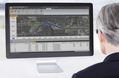
Keeping teams productive and confident within familiar software environments is a goal for any manager and owner. Office staff working currently within Autodesk's AutoCAD Civil 3D platform have now been given the power to directly exchange with the MAGNET system.
Through the established fusion between AutoCAD Civil 3D and MAGNET Office Tools, office staff are now able to be ""at the project site"" and ready to respond to any changes or challenges that may arise.
File transfer between the two software products is more than a time saver, it is a game changer.
FLEXIBLE SOPHISTICATED TOOLS FOR CIVIL ENGINEERING
From desktop to field, Topcon products provide powerful capabilities to facilitate your success.
For geopositioning, construction and mapping professionals the MAGNET suite links field to office in a secure online environment, improving management for entire teams.
Topcon GNSS products deliver superior performance through a broad array of patented technologies.
Combining signals from multiple satellite systems, our GNSS products calculate highly accurate positions in three dimensions.
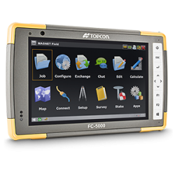
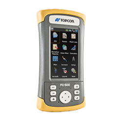
Topcon field controllers incorporate the graphical Windows® operating system on a color touchscreen display.
They simplify data collection for capturing grade waypoints and assuring that you meet spec accurately.
A pioneer in point cloud data creation, Topcon offers solutions to suit your application. These systems employ or combine such diverse technologies as laser scanning, GNSS and photogrammetry while presenting user-friendly interfaces.
Topcon Enterprise Solutions are revolutionary anytime/anywhere connectivity and remote
management solutions that will make every geospatial and construction firm more productive.
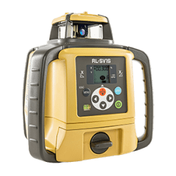
Lasers should just work. Topcon lasers remove the guesswork with auto-levelling,
auto-alignment and other features that let you work faster and more accurately.
Insights & testimonials
We've got you covered
Need more info?
We can email you additional product information. Your contact information will never be shared.
See it in action
Your local dealer can't wait to show you what we can do for your business.

